Galveston Drone LiDAR Mapping
LiDAR Services

"±5cm of accuracy or you don't pay!"

< 5cm of accuracy
or you don't pay!
We aim for 1mm, but guarantee ±5cm

Ready to use!
Our deliverables are ready to use upon delivery.

Fast and better
We can capture 1k or more acres a day.
Using the most advanced systems available, we can create detailed scans of both terrain and physical objects. The engineering industry has begun to use the scans and maps for increasingly more creative solutions. From asset management through comparative LiDAR modeling, to creating entire construction sites in a simulated 3D environment, LiDAR scans can give engineers the tools they need to push the envelope of what is possible.
The Lone Star Drone Advantage:

Certified Pilots

Veteran Owned

Secure Data

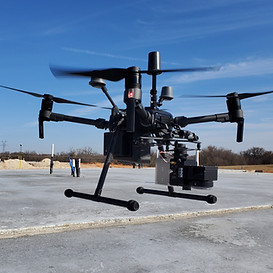
The Best Equipment

Because LiDAR can capture data quickly, large areas that would have taken weeks to capture can now be done in days.

Creating detailed digital models allows for inspection of critical infrastructure and hard to access areas.

LiDAR ADVANTAGE
Faster collection, more accurate, better data.
Lone Star Drone's extensive experience and certifications creates an unstoppable combination. We use only the best equipment and only the best pilots. Our Veteran operators put your mission first.
Some of the ways we have assisted our clients:
Survey
Property Development
Engineering Modeling
Agriculture
Vegetation Management
Energy Sector Inspection
Architectural
Underwater Mapping
Asset Management
City Planning
Law Enforcement
Oil and Gas


There are a lot of applications for Galveston drone LiDAR mapping, and the experts with Lone Star Drone have a deep understanding of all of them. We only use the best equipment, and we only hire the best pilots. When you turn to us for drone LiDAR mapping in Galveston TX, you’ll be able to do so with 100 percent confidence. These are just a few of the ways drone-enabled LiDAR is being used.
Search and Rescue Operations
Galveston drone LiDAR mapping can be a powerful tool when it comes to finding people, regardless of the terrain. The data provided by drones can help rescuers quickly locate a missing person, and then put together the best plan to retrieve them. One of the best things about drone LiDAR mapping in Galveston TX is that the sensors on the drones don’t need light in order to produce that data. As a result, they can help with rescue operations that need to be performed at night.
Drone-enabled LiDAR mapping can also be used for water rescues, since the sensors can measure the depth of a body of water. This can help rescuers not only find humans, but any submerged wreckage as well.
Law Enforcement Operations
Drone LiDAR mapping in Galveston TX can help law enforcement agencies quickly access large areas of land. Officers can monitor a crime scene from a safe distance, even at night or in heavily wooded areas. The sensors provide a detailed accurate picture of whatever situation may be occurring so that officers can quickly decide the best tactics and tools to respond.
Infrastructure
LiDAR drones are also being used to perform structural building inspections to increase the safety of construction sites, eliminating the need to perform manual inspections. When outfitted with cameras, LiDAR drones can help inspectors find potential problems so they can take whatever safety measures are needed.
These just scratch the surface of the many uses of Galveston drone LiDAR mapping. If you would like to learn more, please feel free to get in touch with the experts at Lone Star Drone. You can use our online form, or you can call 817-642-7499.

Time to Get Started
These just scratch the surface of the many uses of Galveston drone LiDAR mapping. If you would like to learn more, please feel free to get in touch with the experts at Lone Star Drone. You can use our online form, or you can call 817-642-7499.