San Antonio Drone LiDAR Mapping
LiDAR Services

"±5cm of accuracy or you don't pay!"

< 5cm of accuracy
or you don't pay!
We aim for 1mm, but guarantee ±5cm

Ready to use!
Our deliverables are ready to use upon delivery.

Fast and better
We can capture 1k or more acres a day.
Using the most advanced systems available, we can create detailed scans of both terrain and physical objects. The engineering industry has begun to use the scans and maps for increasingly more creative solutions. From asset management through comparative LiDAR modeling, to creating entire construction sites in a simulated 3D environment, LiDAR scans can give engineers the tools they need to push the envelope of what is possible.


LiDAR ADVANTAGE
Faster collection, more accurate, better data.
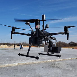
Lone Star Drone's extensive experience and certifications creates an unstoppable combination. We use only the best equipment and only the best pilots. Our Veteran operators put your mission first.

Certified Pilots

Veteran Owned

Secure Data

Because LiDAR can capture data quickly, large areas that would have taken weeks to capture can now be done in days.

Creating detailed digital models allows for inspection of critical infrastructure and hard to access areas.
Some of the ways we have assisted our clients:
Survey
Property Development
Engineering Modeling
Agriculture
Vegetation Management
Energy Sector Inspection
Architectural
Underwater Mapping
Asset Management
City Planning
Law Enforcement
Oil and Gas


While LiDAR (light detection and ranging) has been around for decades, San Antonio drone LiDAR mapping is a relatively recent development. Lone Star Drone has been at the forefront of this innovation, and we continue to set the industry standard. Our equipment is the best available, and our pilots are of the highest caliber. When you turn to us for drone LiDAR mapping in San Antonio TX, you can rest assured you’ll receive accurate, actionable results in the most efficient, cost-effective manner possible.
Drone LiDAR in Brief
San Antonio drone LiDAR mapping is a major evolution from the old method of obtaining data – the use of manned airplanes or helicopters. Drone technology has advanced to the point that these unmanned aircraft can be outfitted with the sensors and lasers needed to ensure accuracy.
LiDAR sensors send out laser light in pulses, measuring the amount of time it takes for those pulses to bounce off the ground and return. These sensors also measure the intensity of the reflections that take place. Drone LiDAR mapping in San Antonio TX involves the use of several sophisticated components that work together perfectly in order to deliver raw data.
The accuracy of drone LiDAR mapping in San Antonio TX cannot be overstated. Traditional methods of conducting LiDAR surveys may be able to cover more ground (anywhere between 4 and 400 square miles in a single flight), but their accuracy limits are typically between 8 inches horizontally and 4 inches vertically. Our drones, on the other hand, can still cover a substantial amount of ground, and through our unique methods, have accuracies between 1mm horizontally and 2mm vertically.

Contact Lone Star Drones if You Would Like to Learn More
There are many more benefits to deploying San Antonio drone LiDAR mapping than can be covered in this space. If you would like more information, the experts with Lone Star Drone will be more than happy to provide it. Simply give us a call at 817-642-7499 or use our convenient online form. We look forward to helping you explore all of your options.