Fort Worth Drone LiDAR Mapping
LiDAR Services

"±5cm of accuracy or you don't pay!"

< 5cm of accuracy
or you don't pay!
We aim for 1mm, but guarantee ±5cm

Ready to use!
Our deliverables are ready to use upon delivery.

Fast and better
We can capture 1k or more acres a day.
Using the most advanced systems available, we can create detailed scans of both terrain and physical objects. The engineering industry has begun to use the scans and maps for increasingly more creative solutions. From asset management through comparative LiDAR modeling, to creating entire construction sites in a simulated 3D environment, LiDAR scans can give engineers the tools they need to push the envelope of what is possible.
The Lone Star Drone Advantage:

Certified Pilots

Veteran Owned

Secure Data

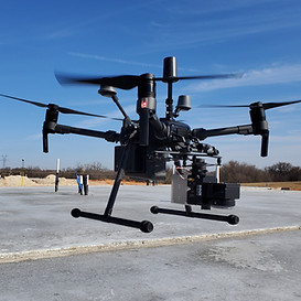
The Best Equipment

Because LiDAR can capture data quickly, large areas that would have taken weeks to capture can now be done in days.

Creating detailed digital models allows for inspection of critical infrastructure and hard to access areas.

LiDAR ADVANTAGE
Faster collection, more accurate, better data.
Lone Star Drone's extensive experience and certifications creates an unstoppable combination. We use only the best equipment and only the best pilots. Our Veteran operators put your mission first.
Some of the ways we have assisted our clients:
Survey
Property Development
Engineering Modeling
Agriculture
Vegetation Management
Energy Sector Inspection
Architectural
Underwater Mapping
Asset Management
City Planning
Law Enforcement
Oil and Gas


When it comes to Fort Worth drone LiDAR mapping, choosing the right company to provide those services will be critically important. At Lone Star Drone, we believe we’re the very best at drone LiDAR mapping in Fort Worth TX. These are just some of the reasons why you should turn to us first, each and every time.
Penetration Capabilities
If you need Fort Worth drone LiDAR mapping in an area covered by vegetation, our equipment will be ready to handle the challenge. Many survey and mapping projects often require terrain models involving dense brush, trees and more. Some may even require identifying specific types of trees. The equipment we use for drone LiDAR mapping in Fort Worth TX is up to that challenge. Our drones are outfitted with sophisticated technology that can easily penetrate the area that needs to be surveyed, regardless of how dense the vegetation may be.
We’re Obsessed With Quality
The professionals with Lone Star Drone work incredibly hard to ensure total client satisfaction. When you turn to us for drone LiDAR mapping in Fort Worth TX, you can do so with complete confidence as a result. We pride ourselves in delivering accurate, precise results, and we have the most stringent quality control processes in the industry.
When a client contacts us for a project, the stakes are typically very high. That’s why we go to great lengths to ensure that every one of them is performed in a streamlined, systematic fashion. We will deliver the best possible outcome with each and every project we undertake.

Experience and Skill
Another reason to choose Lone Star Drone is that we only use the most sophisticated equipment available, piloted by skilled, certified pilots who are committed to their craft. We hold ourselves to higher standards than other companies that offer similar services, and we’re ready to put that passion to work for you.
Learn more about our Fort Worth drone LiDAR mapping services by calling Lone Star Drone at 817-642-7499 or by using our convenient online form to get in touch.