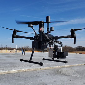
Houston Drone Mapping Services
You could spend a lot of money on equipment, and an incredible amount of time learning how to do your own Houston drone mapping services. Or, you can hire the experts with Lone Star Drone. We have years of experience providing the very best drone mapping services in Houston TX. Not only will you receive incredibly precise results, you also won’t have to bust your budget in the process.
Why DIY Drone Mapping is Never a Good Idea
You’d be surprised at how many business executives assume they can just go buy some equipment and, instead of hiring professionals for Houston drone mapping services, take a DIY approach. This almost never works out. These are just a few of the reasons why this is the case.
-
Those who don’t use drone mapping services in Houston TX will typically not have the slightest idea of the importance of accuracy. It’s critical. If a map isn’t accurate, it’s worthless. DIYers also don’t understand the concepts of the different kinds of accuracy – relative, absolute and survey-grade. If your maps are going to be worth using, you’ll need to be intimately familiar with these terms. At Lone Star Drone, we have a deep knowledge of every aspect of accuracy.
-
DIYers will also typically not even consider using GCPs, or ground control points. Why is this important? If GCPs aren’t properly laid out, the map won’t be correct. This is a very detailed, time-consuming process. When we provide drone mapping services in Houston TX, we deliver accurate, reliable GCPs.
-
Front and side overlap are also incredibly critical to a usable drone map. The more overlapping footage your drone produces, the better off you’ll be. If you don’t have any idea of why this is the case, then you’ll definitely need to partner with a professional.